")
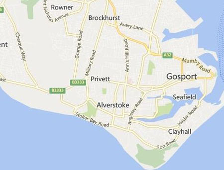
Location of Alverstoke Parish Centre
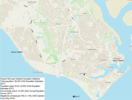
Located at the southern end of the Gosport peninsular in Hampshire, Alverstoke parish today is bounded by Browndown and the Alver Valley to the West, Stokes Bay on the Solent to the south, and Portsmouth Harbour to the East. The locality is continuous with Gosport and Fareham to the north, Lee on Solent and Rowner to the West, and encompasses Haslar Creek at the western entrance of Portsmouth Harbour.
Alverstoke centre is surrounded by residential development mostly dating from the twentieth Century, and the parish contributes around 18,000 people to the Gosport Borough population total of 85,000.
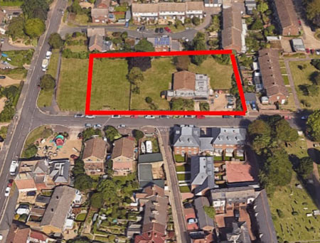
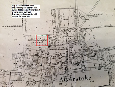
The present Parish Centre was built in 1968 on land that once formed part of St Mary's Churchyard. An act of Parliament in 1965 gave the Parish of St Mary's the right to use the burial ground for building or other purposes, once all human remains were removed. Details of the Governance of the land and building are provided under: Project/Governance.
References - Gosport Borough Website